


PROPERTY SEARCH

Severe winds and yet more rain: Spain weather forecast February 5-8
The powerful gusts should ease on Friday but another Atlantic storm will arrive in Spain on Saturday
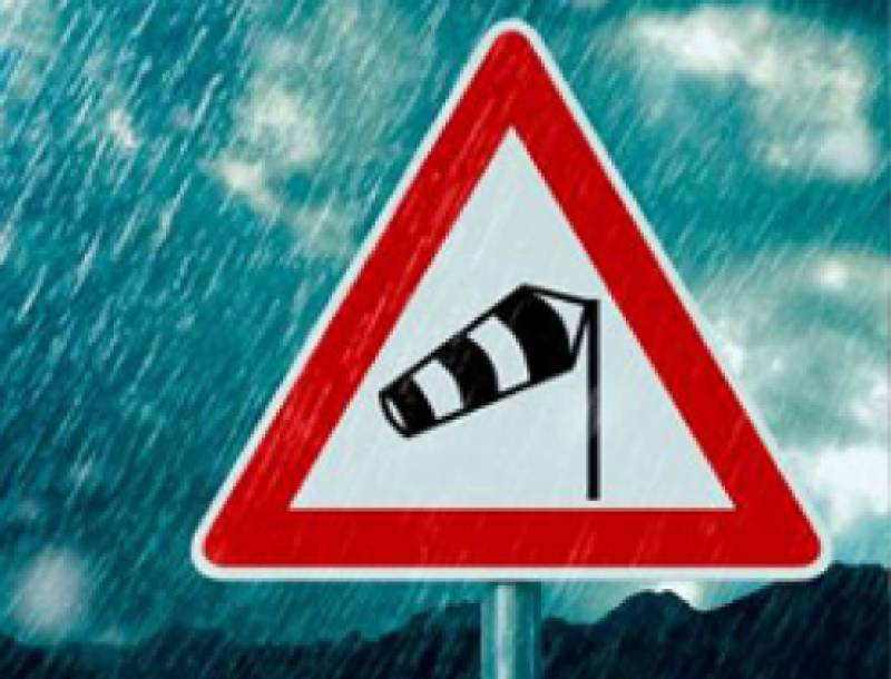
Spain is bracing for round two of Storm Leonardo, which will bring fierce winds to much of the country on Thursday February 5, with gusts topping 100 km/h in mountainous areas across the south and along exposed stretches of the Alboran Sea coast.
The State Meteorological Agency (Aemet) has issued serious weather alerts for 13 autonomous communities, with wind speeds generally expected to hit between 70 km/h and 100 km/h. Andalucia and Castilla-La Mancha are under orange alert, the more serious of the two warnings, and Aragon, the Balearic Islands, Cantabria, Castilla y León, Extremadura, Galicia, Madrid, Murcia, Navarra, La Rioja and the Valencian Community are all on yellow alert.
The storm will start to weaken from Friday but there's little respite in sight, with another Atlantic storm forecast to arrive on Saturday bringing fresh instability.
Thursday February 5
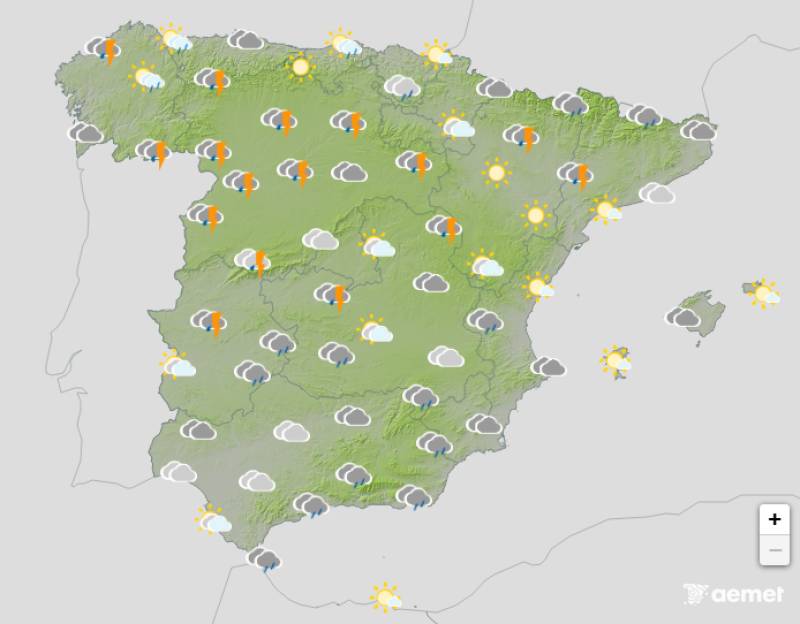
Wind will be the main concern on Thursday, with very strong gusts across most of Spain except the northeastern third of the country. Widespread and persistent rain is expected during the first half of the day as moisture-laden air and new Atlantic fronts associated with Leonardo move in.
Parts of Andalucia, central Spain and Galicia can expect locally heavy and exceptionally persistent rainfall. Aemet warns that some localised areas could see more than 300 litres per square metre over the next couple of days.
A cold front will also trigger showers that could be heavy and accompanied by hail across the western third of the country, particularly in Galicia. With soil already saturated and snow melting, there'll be a significant impact on rivers in the Atlantic and Mediterranean watersheds of Andalucia, Extremadura and Castilla y León. Rough seas will intensify in the Cantabrian Sea and persist in the Alboran Sea, spreading to the Balearic Islands.
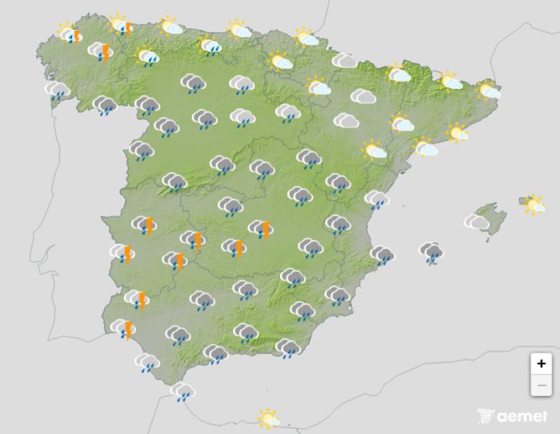
Friday February 6

Leonardo will gradually start to lose steam on Friday but its influence will linger, particularly along the Atlantic coast. Rain is expected within the cold air mass now over the country, affecting Atlantic coastal areas mainly and to a lesser extent the Mediterranean coast.
The arrival of colder air will also bring the snow level down significantly, dropping below 1,000m in the northwest and settling between 1,200m and 1,400m across the rest of the country.
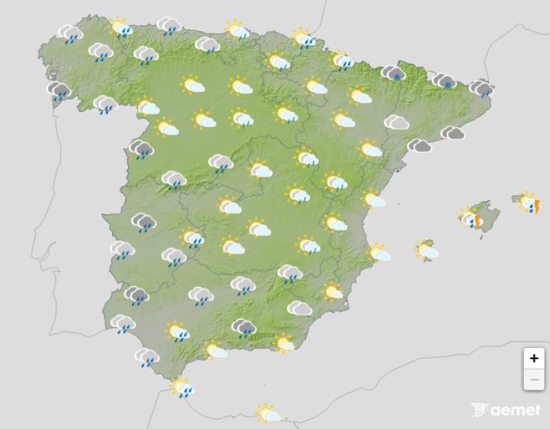
Saturday February 7
Just as Leonardo backs off, another Atlantic storm is set to arrive on Saturday, ramping up both rainfall and wind once again. Very strong gusts are forecast for the southern and southeastern third of Spain and significant rough seas are expected in Galicia and the Cantabrian Sea.
Persistent rain is possible around the Strait of Gibraltar and along Andalucia's Mediterranean coast. Wind gusts could be very strong across the southern and southeastern thirds of the country.
Rough seas will remain significant in Galicia and the Cantabrian Sea, though conditions should gradually improve throughout the day. The Mediterranean is expected to stay much the same.
Sunday February 8
High pressure will settle over the southwest following the passage of Saturday's storm. There's still a chance of showers but nothing like the severity of previous days. Westerly winds will continue and very strong gusts are possible in the eastern third of the country.
Aemet is urging people to keep a close eye on forecasts over the coming days given how persistent this unsettled weather has been and the potential impact on rivers and water levels.
For more weather news go to our Weather & Climate page or follow the Spain Weather Watch Facebook group for regular updates
Images: Aemet


Sign up for the Spanish News Today Editors Roundup Weekly Bulletin and get an email with all the week’s news straight to your inbox
Special offer: Subscribe now for 25% off (36.95 euros for 48 Bulletins)
OR
you can sign up to our FREE weekly roundup!
Read some of our recent bulletins:
Discount Special Offer subscription:
36.95€ for 48 Editor’s Weekly News Roundup bulletins!
Please CLICK THE BUTTON to subscribe.
(List price 3 months 12 Bulletins)
Read more stories from around Spain: